Written by. Sophie Fathima Primannisa Alyindra
The field activities conducted on 21 January 2026 marked the official launch of the Pematang Rahim Living Lab, initiated by the IPB Center for Applied Research of Nature-based Solutions (I-CAN). The initial phase of peatland restoration activities starts with the collection of integrated baseline data on peatlands within the Sungai Buluh Village Forest, Jambi Province, which is critical in establishing a long-term learning and collaboration platform for the application of Nature-based Solutions (NbS) in tropical peatland ecosystems, through inclusive and sustainable restoration and conservation. This peatland restoration is part of the I-CAN Living Laboratory approach, to facilitate evidence-based and innovation for sustainable ecosystem restoration and conservation.

(Doc. I-CAN/Sophie Fathima)
A Strategic Living Lab Landscape in Jambi
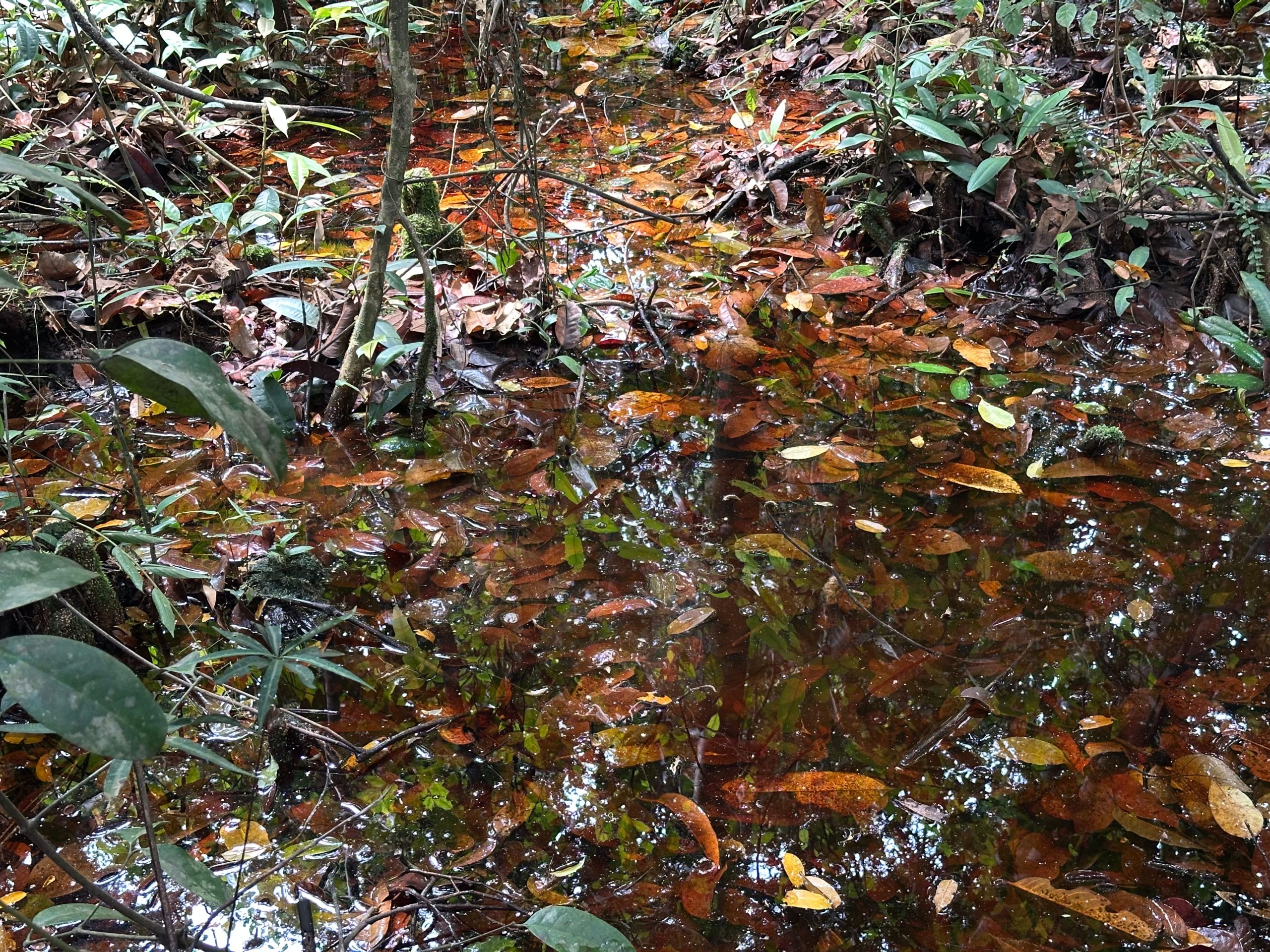
The Pematang Rahim Living Lab is located within the Sungai Buluh Peat Protection Forest in Tanjung Jabung Timur Regency, a landscape that reflects the typical dynamics of Sumatra’s peatlands. The area encompasses intact peat swamp forests alongside degraded sections and demonstrates a strong interdependence between ecological functions and local livelihoods. In response to escalating degradation pressures, restoration of the Sungai Buluh area within the Pematang Rahim Living Lab constitutes both an ecological necessity and a development priority.
Prof. Dr. Ir. Sri Wilarso Budi R., M.S., an expert from IPB University, emphasized the importance of data collection for protecting this area, stating, “The Sungai Buluh Peat Protection Forest represents a peatland area that remains in relatively good condition and requires conservation for nature protection.”
Peatland ecosystems in this landscape are increasingly threatened by drainage, recurrent fires, illegal logging, and land-use conversion, processes that intensify peat oxidation, carbon emissions, biodiversity decline, and hydrological instability. These biophysical impacts are closely intertwined with socio-economic vulnerabilities, as local communities depend heavily on peatland resources for their livelihoods. Consequently, restoration efforts must be designed not only to recover ecological functions but also to sustain and enhance community well-being.
Integrated Baseline Data Collection Approach
A comprehensive assessment was conducted to understand the biophysical conditions of both natural and degraded peatlands. For each land cover type, the study area covered 1.2 hectares, divided into six transect plots, allowing researchers to capture detailed and representative field data.
Vegetation surveys were carried out using 20 m × 100 m transect plots, subdivided according to vegetation growth stages, including seedlings, understory plants, saplings, poles, and mature trees. Data collected included species composition, number of individuals, diameter at breast height (DBH), and tree height. These measurements form the basis for analyzing forest structure, biodiversity, regeneration potential, and overall ecosystem stability.![]()

Peat characteristics were examined through the collection of disturbed and undisturbed soil samples down to 90 cm depth, combined with direct field measurements of peat thickness and maturity levels (fibric, hemic, and sapric). These observations provide insights into peat decomposition status, physical and chemical properties, and the peatland’s capacity to store carbon and regulate water. Hydrological conditions were assessed by monitoring water table levels using installed measurement pipes, while land subsidence was recorded to detect changes in ground surface elevation over time both critical indicators of peatland stability and degradation risk.
Carbon analysis was conducted through two main approaches: carbon stock estimation and greenhouse gas emission measurements. Carbon stocks were calculated from above- and below-ground biomass, necromass, and soil carbon. Tree biomass was estimated using established allometric models, while seedlings, understory vegetation, and litter were measured directly through field sampling. In parallel, CO₂ and CH₄ emissions were measured using the closed chamber method at multiple times of the day to capture diurnal emission variability from peat surfaces.

In addition to biophysical measurements, the assessment also captured the social and institutional context of peatland management through direct engagement with local communities. Field observations and interviews with village leaders and representatives of the Village Forest Management Institution (LPHD) provided insights into governance arrangements and livelihood conditions.
To ensure the baseline data reflected the voices of all community members, a series of Focus Group Discussions (FGDs) were conducted with a wide range of stakeholders ranging from farmers, LPHD members, village officials, neighbourhood leaders, youth, and community representatives. Particular attention was given to FGDs with women’s groups, creating a dedicated space for women to share their experiences, roles, and perspectives in peatland use and household livelihoods. This inclusive approach reflects a commitment to leaving no one behind in the baseline assessment process.
The assessment was further supported by farmer household surveys, alongside gender and household income analyses, to better understand land use practices, livelihood structures, and community dependence on peatland resources. Together, these approaches ensure that peatland restoration planning is informed by both scientific evidence and inclusive community perspectives.
From Baseline Data to Action
The results of this integrated assessment provide essential baseline information for guiding peatland conservation, restoration planning, and climate change mitigation strategies. By clearly documenting current peatland conditions, the Pematang Rahim Living Lab establishes a strong scientific foundation for evaluating future interventions and long-term ecosystem change. Following the baseline phase, I-CAN will move into data analysis and synthesis, integrating biophysical, carbon, and socio-economic findings to design Nature-based Solutions that are scientifically sound, socially inclusive, and locally relevant.
At present, baseline data for the Pematang Rahim Living Lab are still under analysis to determine priority targets for future management and restoration actions. Initial observations indicate that one of the most visible and immediate plans is to implement revegetation in degraded areas identified through remote sensing imagery. This early intervention is expected to support the recovery of vegetation cover, improve hydrological stability, and reduce vulnerability to fire and further peatland degradation.
Beyond serving as a site for research and learning, the Living Lab is envisioned as a collaborative platform that brings together local communities, government institutions, and non-governmental organizations. Through this collaboration, the initiative aims to strengthen sustainable peatland management practices while simultaneously enhancing local livelihoods.
According to Edi Suprapto, Head of the Conservation Protection and Community Empowerment Section of UPTD KPHP Tanjung Jabung Timur, forest sustainability is closely linked to community welfare. “When communities are prosperous, forests can remain sustainable because people no longer depend on logging as their main source of livelihood,” he said.
By promoting inclusive management and developing economic opportunities derived from restoration outcomes, the Pematang Rahim Living Lab seeks to generate long-term ecological benefits alongside improved community well-being.